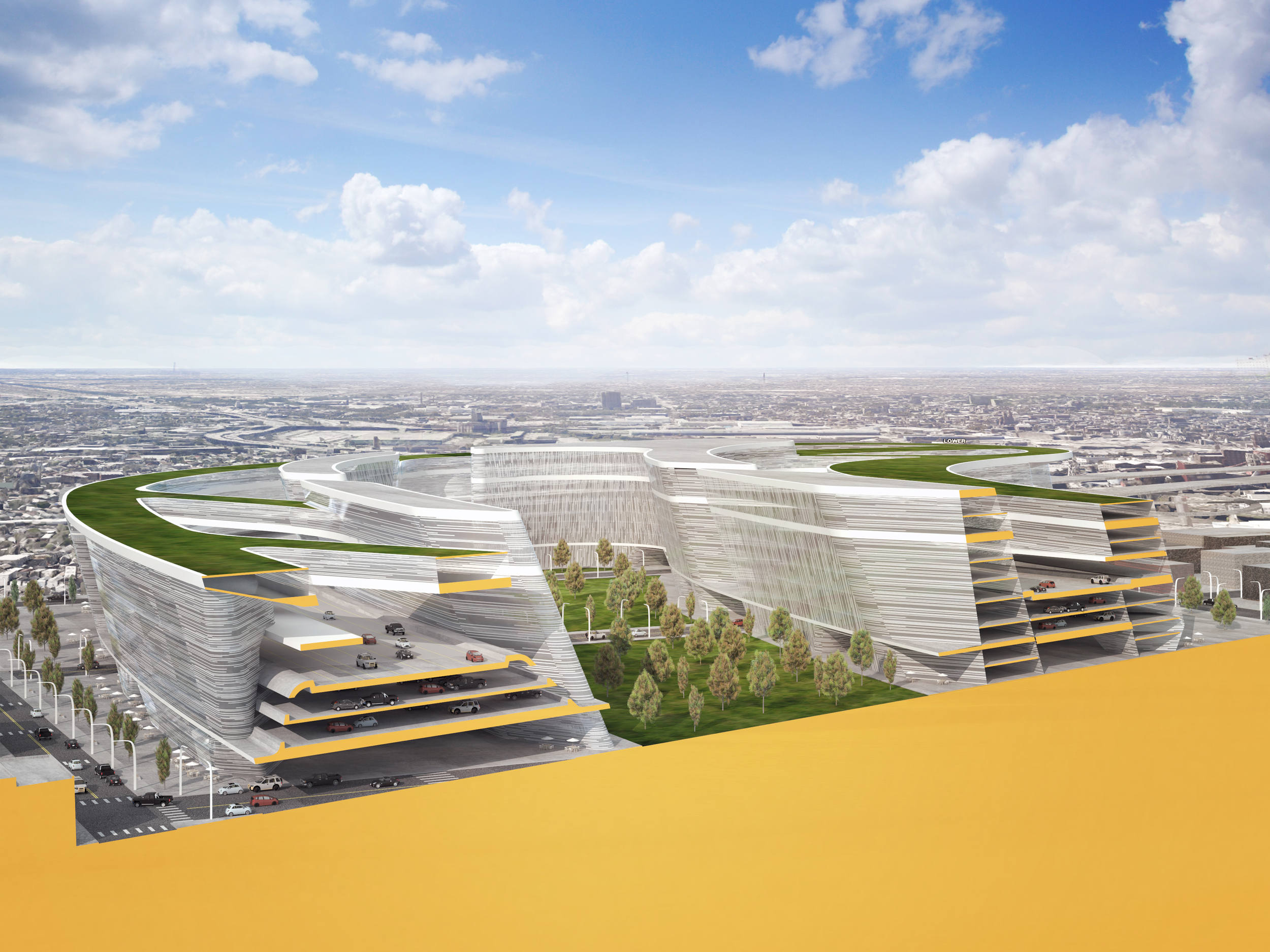
South Site
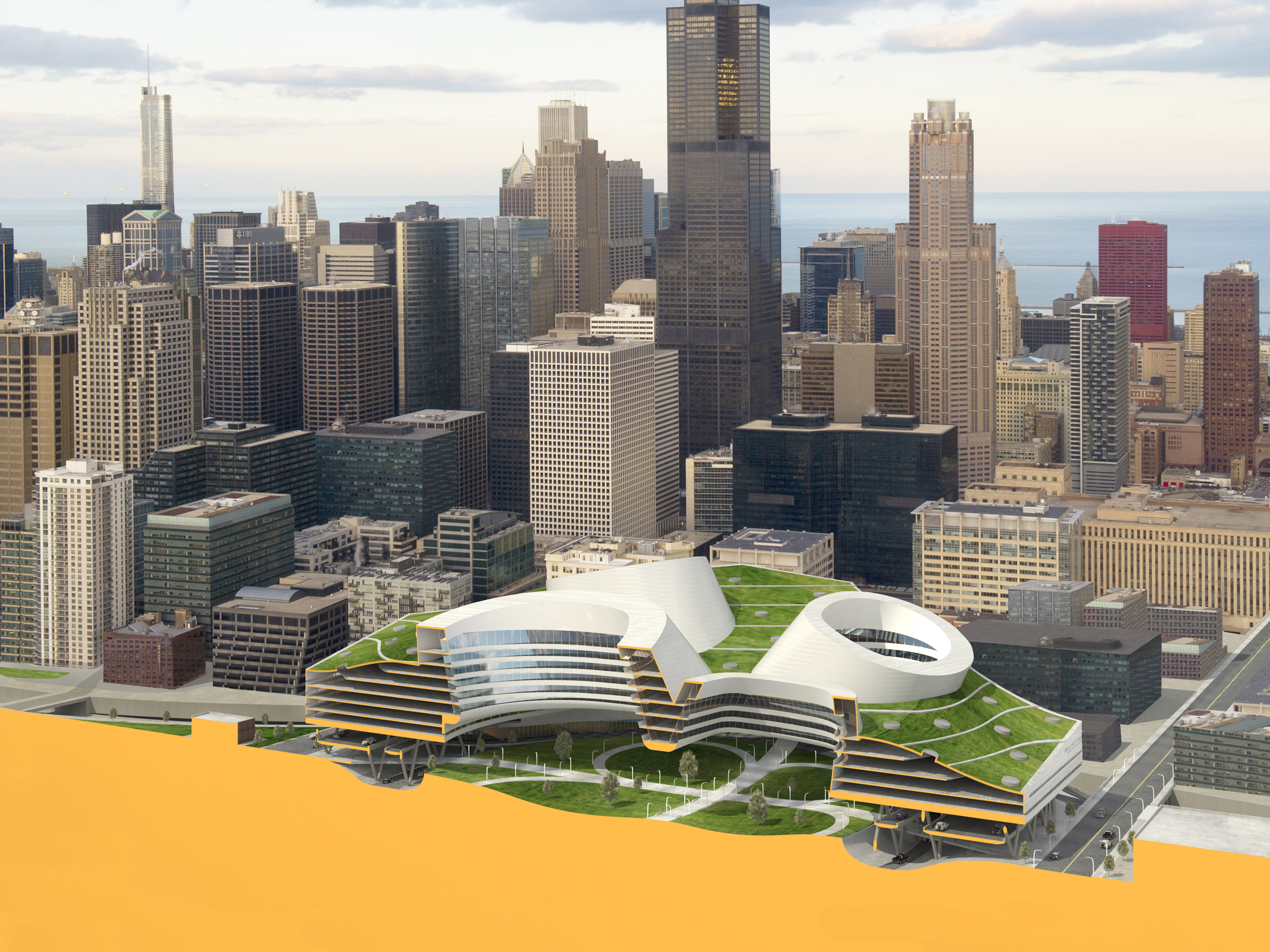
Chicago Loop: Cloverleaf Building
Rules of the Road
Connecting Cities to Underutilized Freeway Infrastructure Zones Through Parametric Urbanism
Transportation infrastructure such as waterways, Roman roads, railroads or the federal highways have always informed the design of cities. The National Interstate and Defense Highways Act of 1956 forever changed transportation, economic flows, connectivity and the landscape of the US. The mechanical efficiency required for the success of the freeway is created through separation from everything that might slow it down but unfortunately the benefits of speed created by separation are constantly at odds with the slower, finer-grained, human concerns of dense urban cores.
Many designers have considered the forces, forms, and implications of the freeway with wholesale utopian visions of buildings and roads merging into mega-infrastructural proposals such as Chambliss’s 1910 “Roadtown” or Jellicoe’s 1961 Motopia. Rather than negate the rich existing conditions of rustbelt cities and their infrastructures, Rules of the Road will engage the Federal, parametric, Fordist logic of the freeway with the requirements of a post-Fordist city and proposes parametric urban design strategies that mitigate environmental, social, and formal concerns with an architecture that engages large swaths of underutilized freeway infrastructure zones.
Rules of the Road is fascinated by the morphology of the Federal Highway System and its impact on the American landscape. On a large scale it operates as macroeconomic desire lines and on a small scale the system is beholden to constraints of speed as derived from the machines that use it. The efficiencies of logic that create sweeping concrete curves and allow for high speeds are unable to make efficient use of space when slowing down to engage urban areas.
This either / or scenario presents an exciting condition to study. From one perspective the unrelenting, clear logic demonstrates the extreme result but the problem is that it is just one of many possible trajectories produced by optimization algorithms. There are many other possible trajectories and since the late fifties when the National Interstate and Defense Highways Act was enacted, things have changed. Network thinking, computational logics, and multidisciplinary approaches teach us that we no longer live in a binary world that must choose only one extreme, instead we mix, blend, morph, and tinker. We also now know that objects optimized for only one function are not as robust as objects that can have multiple functions (and possibly multiple lives). Parametric modeling allows designers to input and refine rules in such a way that one can operate like an alchemist mixing ingredients and refining output so that the result might be suitable to more than one rule set and simultaneously benefit multiple constituencies.
Parametric Modeling allows a designer to dynamically define rules, relationships, and parameters that produce form. In many cases we see or live with the result of decisions without understanding the rules that govern a given form. Rules of the Road will explore the rules that dictate the forms of the highway system and explore the rules that define great urbanism. Historically these two rule sets have been worked in isolation and as a result the accepted practice is to not let buildings (or people / pedestrians) get too close to the highway.
Slopes of earth, turning radii related to car speed, and percentage of inclines are all rules used to define highway interchanges. Heights of buildings related to width of streets and floor area ratio all determine different forms of urbanism. Parametric modeling allows us to input these rules and create many resultant forms through the processing power of the computer. What felt like strict rules with few outcomes now become malleable, able to produce previously unknown possibilities through multiple iterations.
The project will begin with the investigation of key highway infrastructure areas in Chicago and Detroit. The existing highway will be parametrically modeled to understand the existing rules that produced the current form. Alternative rules will be tested that will produce new infrastructure zones with adjacent buildings and urban density. The project will then analyze the combined success of these alternative iterations related to speed and density as understood through secondary criteria such as access to light, mitigation of sound and pollution. Previously the job of the highway was to create speed but given new approaches for design can new forms of highway produce efficient mobility while creating new spaces to live and work?
Project generously supported by the Taubman College Research on the City Grant Program
team: DAUB / Karl Daubmann / Cezanne Charles / John Marshall / Qetuwrah Reed / Ryan Goold / Claire Matucheski / Patrick Ethen